Hike with a plan.
WeHike is a hiking app built around the map: trails scored by the people who walk them, recording that works without a signal, the weather for the day you go, and group outings that bring everyone back.
For Android 8.0 and later. Free to use, with no ads.
Lalla Khedidja from Tikjda
E4 · T3 · R2- Distance
- 16.4 km
- Elevation gain
- 1,020 m
- Estimated time
- 6h 40m
Everything happens on the map
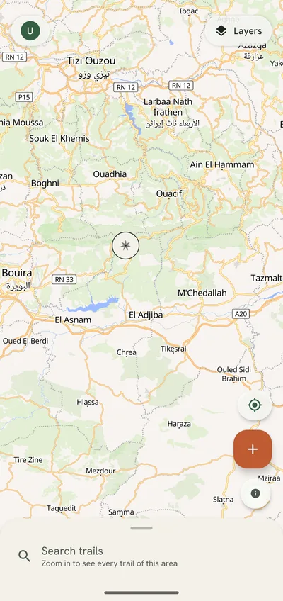
No tabs and no feed. Trails, planned hikes and outings open in one sheet over the map, the way you read a map on the trail.
Trails scored by the people who walk them
Each trail pin carries a petal glyph: seven petals for technicality, exposure, waymarking, scenery, shade, water and crowds. The longer the petal, the higher the score. An outlined petal is not rated yet.
E3 · T2 · R1 The grade sums up the rest: effort computed from the track, technicality on the SAC hiking scale, and risk voted by hikers. Tags tell you if a trail suits families, dogs, strollers or trail running.
-
Recording that keeps going
Tap Record and put the phone away. WeHike records with the screen off and without a signal, and pauses when you stop. Follow a trail and it warns you when you leave it.
-
Offline maps
Download a trail before you leave: the map along it stays on your phone. Keep three at a time for free, or as many as you like with WeHike+, plus whole regions.
-
Planned hikes, with a weather verdict
Pick a trail and a day. WeHike reads the forecast for your hike window and says go, caution or no-go, with the reasons. It checks again 48, 24 and 6 hours before you start.
-
Group outings
Publish an outing with a meeting point, places and an RSVP deadline. A waitlist fills free places, people check in at the meeting point, and you close the day once everyone is accounted for.
-
Safety and privacy
Published tracks lose 200 m at both ends, everything inside your privacy zones and their times. Report and Block are in every menu. Safety features are free on every plan.
How it works
-
Find a trail
Browse the map around you. Petals and grades show what a trail is like before you open it.
-
Plan the day
Choose a date and a start time. The weather verdict tells you whether to go, and WeHike reminds you the day before.
-
Go, and come back
Download the trail, record your hike and rate the trail on the way home. Going with others? Make it an outing.
Take a group out. Bring everyone back.
For clubs, guides and agencies: publish an outing, fill it from a waitlist, decide with the weather when RSVPs lock, count heads at the meeting point and close the day once everyone is accounted for.
- Draft
- Published
- Locked
- Ongoing
- Done
Questions
Is WeHike free?
Yes. Browsing, recording, publishing trails, the weather verdict and joining outings are free, with no ads. WeHike+ and Organizer lift the limits of the free plan.
When can I get it?
WeHike is in closed testing on Google Play. Join the beta to use it now; the public release follows the test.
Does it work without a signal?
Recording always works offline. Download a trail before you leave, or a whole region with WeHike+, and the map works too.
Which phones does it run on?
Android 8.0 and later. There is no iPhone version yet.
Which languages does it speak?
English, French, Arabic, Spanish, German, Italian and Portuguese.
Where do the trails come from?
From hikers. Every trail was recorded or uploaded by a member, then scored by the people who walked it. WeHike does not copy trails from other apps or sites.
Help us bring WeHike to Google Play
WeHike is in closed testing. Join the beta, take it on your next hikes and tell us what to fix before the public release.